About the site
CATEGORY OF PROTECTION: Significant Landscape
YEAR OF PROTECTION: 1967
SURFACE AREA: 10,006.56 ha
POSITION: Municipality of Murter; Kornati archipelago north of Kornati National Park
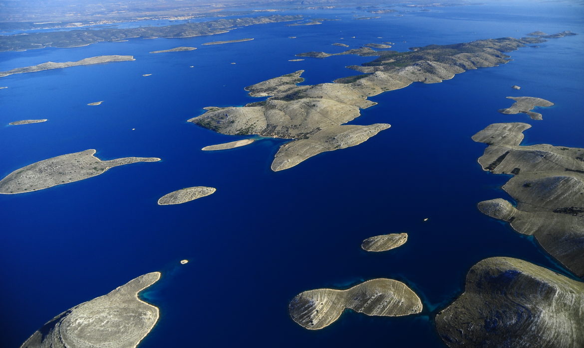
The Kornati archipelago is divided into four island groups, named after the chief islands among them: Piškera, Kornat, Žut and Sit. The Žut-Sit island group is bordered by Pašman to the north, Vrgada to the east, Dugi Otok to the west, and Kornat to the south. It includes thirty-five islands and islets, eight crags and one reef. The largest of the islands is Žut, with a surface area of 14.81 km2, and its highest point (176 m) on Gubavac hill. The second largest is the island of Sit, with an area of 1.63 km2, and its highest point at Veli vrh (84 m).
Karst is the chief attribute of the terrain and one can see an abundance of karst formations created by corrosive and erosive processes (solution pans, lapies, gutters…). The islands have no spring waters and consist mostly of rudist and chondrodont limestone. In the geological past, they were a part of the mainland and took on their present day appearance after sea levels rose 10 thousand years ago. The shorelines are indented (bays, coves, capes…) and the beauty of the landscape brings out the contrasting blue of the sea and the white of the carbonate rock, sparsely populated by Eumediterranean vegetation.
The Žut-Sit archipelago belongs to the Eumediterranean vegetation zone. Forest vegetation consists of evergreen forests and holm oak.
The terrestrial fauna of Žut-Sit Archipelago has not been systematically studied.
The first traces of human habitation on Žut are from the time of the Liburni, as testified by the prehistoric hillfort at the Grba site and barrows at Pinizelić and at Pod Ražanj. Shepherds lived on these islands during the Roman rule. The first written mention of the island is in a list of islands in the waters off Zadar dating from the 11th to 14th century, where its name is spelled Xut, while the first information about the island dates to the 15th century. At the time the island was owned by the Zadar-based aristocratic family of Civaleli, while in 1824 the owners registered in the cadastral plan of Sali are Božo (Natale) and Kristofor Dominis, nobles from Šibenik. In the second half of the 19th century, the island passes into the hands of families from Murter Island. There are no permanent settlements on the island, and its seasonal inhabitants are fishers, shepherds and farmers (olive and vine growers).