About the site

CATEGORY OF PROTECTION: Significant Landscape
YEAR OF PROTECTION: 1967
SURFACE AREA: 1 139,90 ha
POSITION: Municipality of Drniš
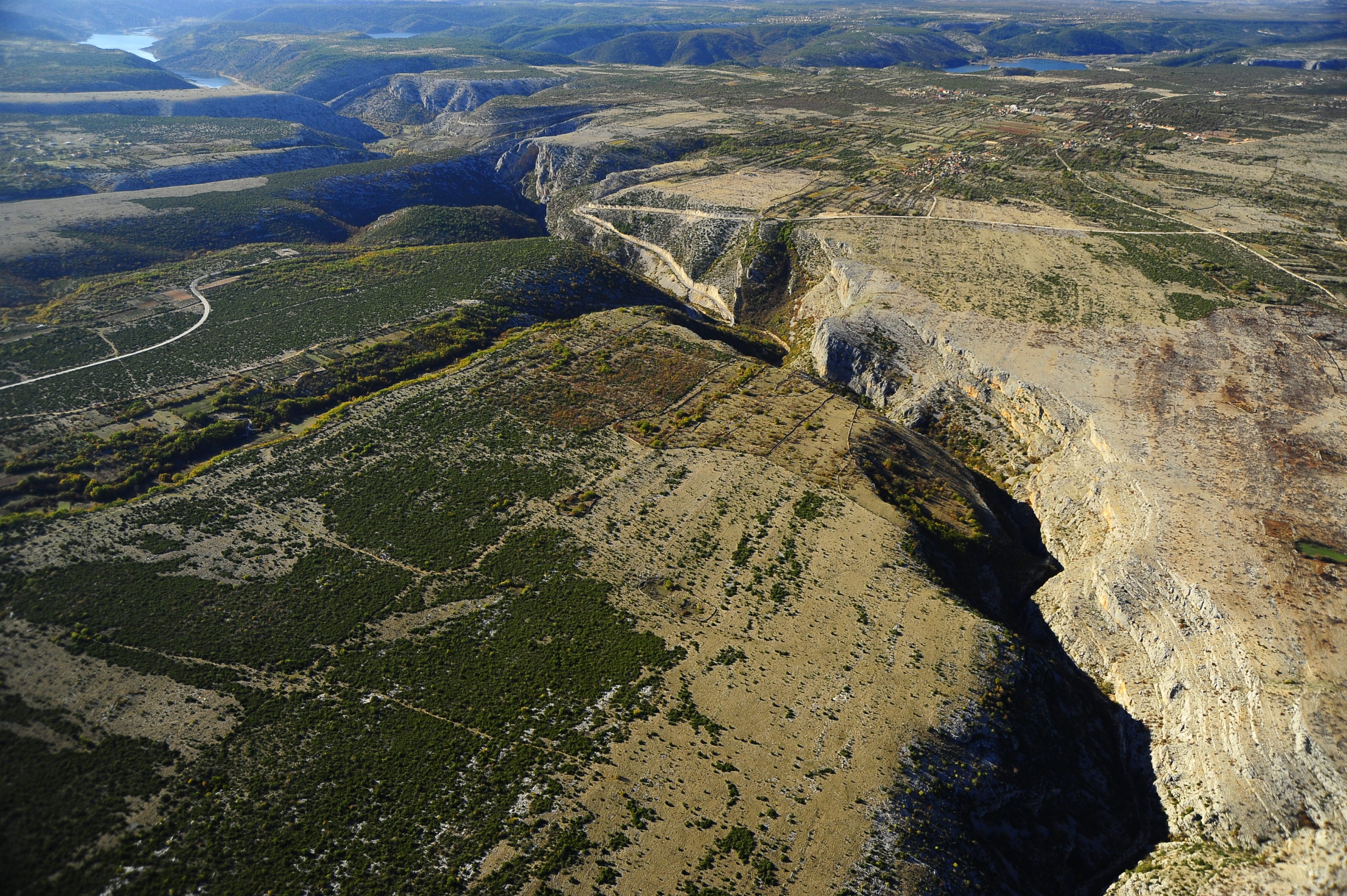
The significant landscape includes 13 km of canyon up to 130 m high, from the end of Petrovo Field near Drniš to the border of Krka National Park, 300 m downstream of the bridge over the Čikola River on the road Pakovo Selo – Ključ. The canyon separates the Miljevac villages situated in the northwest and the villages of Pakovo Selo and Žitnić in the southeast.
There are a number of subterranean habitats in the Čikola River Canyon (caves and sinkholes), the best known of which are the caves at Brini and Topla peć cave. The first traces of human habitation in Šibenik-Knin County, dating from the Late Palaeolithic (about 18,000 BC), were found at the caves at Brini situated in the western section of the Čikola Canyon, 4 kilometres from Drniš. The remains of animal bones from the Upper Pleistocene were unearthed (cave bear, hyena, alpine marmot, wild horse, ibex, bison and the like) and artefacts from Palaeolithic man of the Mousterian culture (including scrapers, cutters and borers).
The geological structure of this area is dominated by limestone of Mesozoic and Paleogenic age, with a dolomite belt. In some areas, the thick series of Mesozoic limestone are covered by young layers of marl, sandstone and conglomerates, such as Upper Cretaceous flysch. The karst plateau was created at the end of the Pliocene and beginning of the Pleistocene. Since the end of the Pleistocene, the Čikola canyon has been cut into the plateau, and represents an exceptional geomorphological phenomenon of karst. The area was further shaped by subsequent erosion processes. During the dry summer period, the eddy wells, sand spits, roundstones and travertine are visible in the canyon, while wrinkles, layers and funnels are visible at the edges of the canyon.
The Čikola River is the longest tributary of the Krka River (together with the Vrba River, 47.8 km), and springs under Svilaja mountain in the southeastern part of the Petrovo Field (an alluvial plateau, with an area of 50 km2) near to the village of Čavoglava. The catchment basin has an area of 836.8 km2. The Čikola drains into the Krka just above Skradinski buk. The mouth and the last three kilometres of the Čikola River are submerged today, due to the growth of the travertine barrier at Skradinski buk. Along its course, the Čikola River creates several lakes, such as Ovčjak near the village of Knezovi, and the Lasmač and Saranča falls (Kotline). During rainy periods, the river is active, while during the dry period it dries out at the beginning of the canyon, just after Drniš. During that time, the dry riverbed is passable all the way to the Torak spring.
The Čikola River canyon belongs to the deciduous or Submediterranean zone of the Mediterranean vegetation region. The flora is comprised of 298 plant species.
Culture and historical monuments in the area include the Osoje prehistoric hillfort near Pakovo Selo at the edge of the canyon, eight kilometres to the southwest of Drniš, a road and the remains of structures from the period of Roman administration at the head of the canyon near Drniš and the Drniš hillfort near the Šibenik–Knin road at the edge of the canyon at an altitude of 334 m. Archaeological finds dating from prehistory to the latter half of the 19th century have been found at the Gradina hillfort. The current traces in the southern end are the remains of a medieval fortification from the 14th century that belonged to the aristocratic Nelipić family. The round tower and the north-eastern defensive wall are from the period of Turkish incursions. The ruins of water mills and two stone bridges are found under Gradina.